Historic West Point Driving Tour
Welcome to the official driving tour of Historic West Point, Kentucky. This route follows the original roads, riverfront, flood zones, military corridors, and pioneer sites that shaped the town from 1776 through the Civil War, the 1884 flood, Camp Knox, and the modern era.
Driving Tour Map
Use the interactive map below to navigate the tour. Each stop includes a photo, description, and exact location.
How the Driving Tour Works
This Driving Tour follows the historic flow of West Point, beginning at the Civil War era and moving through pioneer homes, riverfront commerce, flood history, military landmarks, and natural sites. The route is arranged to avoid backtracking and follows the actual streets used during the town’s development.
The tour begins near the riverfront with Civil War activity from the Great Raid of 1861, then moves through the oldest part of town—Pioneer Cemetery, the James Young properties, Young’s Inn, and the Sears & Roebuck House. From there, the route follows the river corridor where Lewis & Clark connections and John Shields’ story unfold.
Continuing along the river, the tour passes the Salt Warehouse, Ditto-Lansdale House, the Embarcadero landing, and the K&I Bridge corridor. The Thomas Lincoln Flatboat site and Sherman’s Headquarters mark the Civil War presence in town.
The route then follows Elm Street (historically Water Street), the area devastated by the 1884 and 1937 floods. Here you will see the 38th Parallel marker, Veterans Park, the Great Flood of 1937 marker, the Flood Crest Pole, and the Clara Barton relief site.
From Elm Street, the tour continues to Geohagen Street for the James Neel Ford marker, then south along Main Street to the Country Music Stars marker, Camp Knox area, the Louisville & Nashville Turnpike, and Mom & Pop’s Place.
The final portion of the tour takes you out of town to Bridges to the Past, Tioga Falls, and the entrance to Fort Duffield. The route ends with the north and south paths of Morgan’s “On to Ohio” cavalry raid.
Driving Route — Full Tour in Order
- The Great Raid (Nov 1861)
- Fort Duffield Sign
- Pioneer Cemetery
- James Young (1776 Marker)
- James Young House
- Young’s Inn
- Sears & Roebuck House
- Lewis & Clark / John Shields Marker
- Salt Warehouse
- Ditto‑Lansdale House
- Embarcadero
- K&I Bridge / L&N Turnpike
- Thomas Lincoln Flatboat Landing
- Sherman’s Headquarters
- West Point Center Sign
- Civil War Fort Sign (Antique Store)
- Elm Street / Water Street Corridor
- 38th Parallel Marker
- Veterans Park
- Great Flood of 1937 Marker
- Flood Crest Pole
- Clara Barton 1884 Flood Relief Site
- James Neel Ford Marker
- Country Music Stars Marker
- Camp Knox Area (River of Life Church / 31W)
- Louisville & Nashville Turnpike Marker
- Mom & Pop’s Place
- Bridges to the Past
- Tioga Falls
- Fort Duffield Entrance (31W North)
- Morgan’s Route — On to Ohio (North & South)
Featured Story: Clara Barton & the 1884 Flood
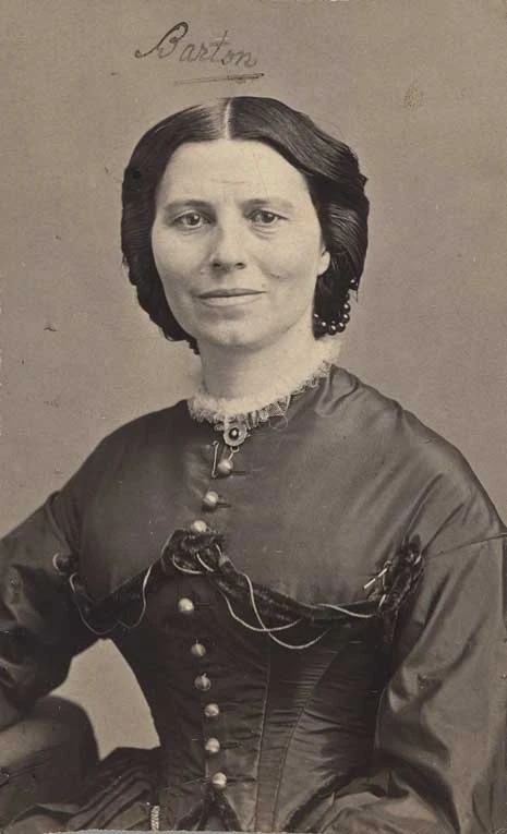
In February 1884, Clara Barton arrived in West Point as the Ohio River rose to catastrophic levels. Her published report described:
“Homes submerged to their roofs… families stranded… destruction of Water Street.”
She remained in town distributing food, clothing, and medicine until the crisis eased. Clara Barton had her HQ’s at the Youngs Inn