Historic View
Looking Back
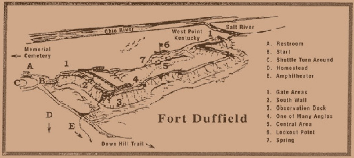
What Happened Here
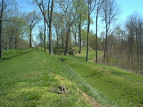
The South Wall formed a natural barrier reinforced by hand‑cut logs, earth, and brush. Soldiers worked quickly in late 1861 to shape this ridge into a defensible line, carving out firing positions and clearing trees to improve visibility. The wall was never tested by a major assault, but its presence deterred Confederate scouts and protected the fort’s interior.
From this vantage point, guards scanned the valley for signs of movement — smoke from campfires, glints of metal, or the distant sound of horses. Even in quiet moments, the men remained alert. The South Wall was a place of vigilance, routine, and the constant awareness that danger could rise from the hills at any time.
Though the original fortifications have eroded, the slope and contours of the land still reveal the defensive logic behind the wall’s placement. The ridge remains a silent witness to the soldiers who once stood watch here.
Interpretive Signage at the Sidewalk
As you approached this station, you passed interpretive information about Fort Duffield and the officers who served here, including General William Tecumseh Sherman, whose headquarters was located in West Point during the early months of the Civil War. The signage also includes a period photograph of Abraham Lincoln, reflecting the national leadership that shaped the Union war effort.
Sherman’s Headquarters in West Point, Kentucky
Sherman’s headquarters—not to be confused with the U.S. Military Academy at West Point, New York—was located in the historic Judge Fisher House, built in 1845. This residence served as Sherman’s command post in 1861 while he oversaw Union operations in the region.
- Location: Elm Street & North 4th Street, West Point, Kentucky
- Historical Significance: Used by Sherman while commanding Union troops in the area
- Structure: Private residence built in 1845, now marked by a historical plaque
- Marker Notes: Highlights Sherman’s use of the home as his headquarters during the Civil War
This site is part of a cluster of Civil War landmarks in West Point, including the Ditto‑Lansdale House (used as a hospital) and the Salt Warehouse, which supported Union logistics.
Listen or Explore More
Audio Narration
Hear how the South Wall protected the fort and shaped daily guard duty.
Primary Sources & Research
Primary Sources Coming Soon
Archival documents, maps, and engineering notes for this stop are being prepared and will be added soon.
Navigation
Walking Tour Quick Links
© 2026 Fort Duffield • Built with GeneratePress